With the emergence of drones around the world, imaging sensors are applied to multiple latest applications and industries. Globally, the commercial drone market is estimated to be worth $501.4 Billion by 2028 with a CAGR of 57.5%. The agriculture drone market is estimated at $32 billion and around 70% of the mining majors have applied this technology. The Government is already creating its Digital Sky platform, which shall provide efficient and transparent governance of the low-altitude airspace. The emerging technologies are merging the boundaries between the physical and the digital. Drones are one such example of emerging technology.
The 2021 Drone Rules have been the “opportunity opener” for the complete Drone ecosystem. The Finance Minister encourages companies to facilitate Drone-as-a-service, which enables enterprises to avail of various services from drone companies. Agriculture, mining, oil & gas, urban planning and many others are the applications of drone-as-a-service.
Organizations across the globes are increasingly using drones to gather geospatial information about every land detail. Inexpensive and easy to use, drones make it easy for non-specialists to make maps and collect aerial imagery. Remote sensing is now an established method for obtaining data for ecological research and monitoring and provides insight into advanced remote sensing methodologies. With alternative remote sensing techniques, processing can be time-consuming but with drones, you can potentially capture large volumes of data in a short period.
Now, let’s know about the CSM’s expertise and technology intervention on geospatial analysis and drones in Mining, Agriculture, Urban Planning, Logistics & Supply Chain Management, and Manufacturing & Inventory Management. geospatial analysis & drone successfully in various platforms. So, the well-known used cases are-
Use Cases: -
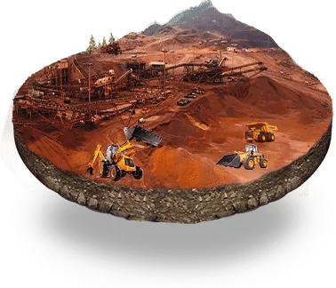
Mining: CSM Tech imposed Drones in Indrani Patnaik Mines to detect lease boundary, land use patterns, Stockpile Identification & Position, and Change in section Pit.
- Lease Boundary Inspection: The mine’s initial CAD drawing can be overlaid on the processed image data captured by the UAV to check for conformity to lease, active area & environmental compliance.
- Land Use Pattern Assessment: Land Use plan furnished that can be validated against the actual surface plan for any deviation
- Change in Production pit status: Monitoring change in bench status between one drone survey to the next and estimating the quantity of material extracted over that period.
- Stockpile identification and position: The mine’s initial CAD drawing can be overlaid on the processed image data captured the by UAV to check for conformity to lease, active area & environmental compliance.
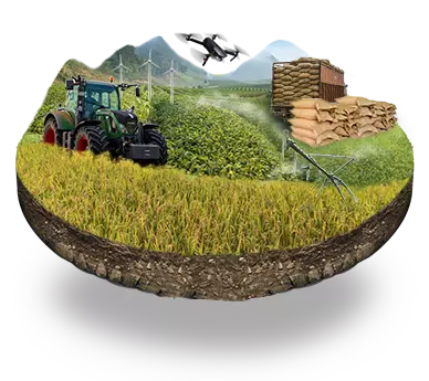
Agriculture:
We also implemented tech solution using Crop One wherein thehigh-resolution satellite images are superimposed with ground democratic data to weed out fraudulent declared paddy land using machine learning algorithms. This saved more than 1000-5000 crores in a single season of government money. And, the IT Secretary shared his views about “the digital integration and technology intervention of ‘Crop Analytics’ to empower farmers and various other emerging technologies”. Goldman Sachs predicts that the agriculture sector will be the second-largest user of drones in the world in the next three years.
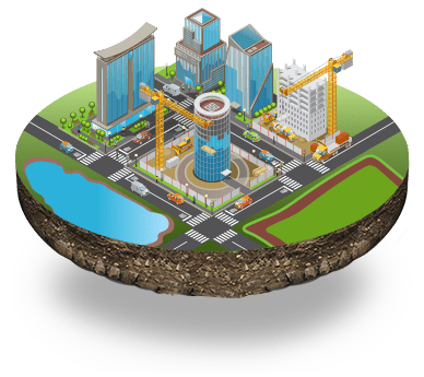
Urban Planning: CSM drones are also used for aerial surveys in disaster management, policy urban infrastructure planning, potential development initiatives, etc.
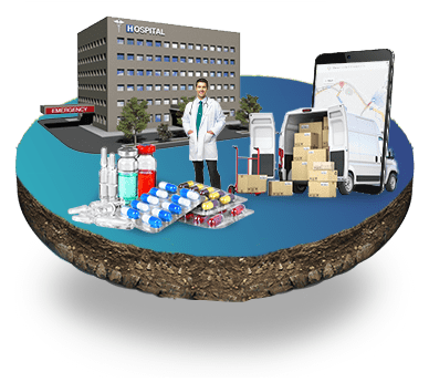
Logistics & Supply Chain Management
- Drones are executed for transportation or delivery of orders to customers for last-mile deliveries in urban areas with heavy traffic congestion.
- CSM Technologies launched CoVaTrack’ for information on Coronavirus treatment during COVID 19 pandemic with the help of GIS mapping. Deliveries of medicines to remote and rural areas are already being tested.
Manufacturing & Inventory Management:
- In mining, our drones measure inventory using barcodes, QR codes or radio-frequency identification (RFID) technology and measure waste or spillage using thermal cameras, laser or ultrasound sensors, or LiDAR scanners.
- Drones are also used to check final orders before being placed on delivery vehicles, identify any missing parts of the order, locate them in the warehouse, and either retrieve them or warn of an impending incomplete order.
Challenges:
- Mining productivity has declined 3.5% over the past decade as mines fail to monitor and manage infrastructure efficiently leading to increased costs of production.
- Endurance: The brick-sized batteries used by drones are weighty and get used up fast.
- Security: The encrypted codes on drones are often the same (i.e. static), which makes them a good and easy target for data hijacking.
- Strength: Drones face a challenge to achieve longer flight times.
Benefits:
- 100% Accuracy with no human intervention
- Ensuring Safety: Drones remove personnel from danger during almost every stage of operation from inspecting benches to measuring stockpiles.
- Ensuring Productivity: Drone-based surveys and inspections are known to save over 60-70% of man-hours while ensuring no data is lost and errors are minimal.
- Ensuring the data is reliable and repeatable: We ensure that the drone data we acquire is reliable and repeatable through timeline-driven project management so that you can forget about getting the data and focus on using it.
- Ensuring Compliance: One absolute source of truth can be used to manage all aspects of safety and regulatory compliance to ease reporting and monitoring. The accuracy and frequency of monitoring to conform and control operations can be as much as once a week to ensure m-level compliance.
- Sustaining Infrastructure: Critical equipment performance and health can be tracked on a day-to-day basis and visualized over an hourly basis.
CSM as partners with Skylark Drones used their technology in mining at Indrani Patnaik Mines to monitor the inaccessible areas and all geo-referenced images along with the control points are fed into the software where photogrammetric processing takes place. CSM has also featured Geo-Spatial applications for the Crop One solution in the AgriGate platform where this system is highly authenticated, validated, and visualized accurately.